If you're looking for beautiful and historic Dolomites hiking tours, the Alta Via del Granito might be just what you're looking for. This circular crossing takes you through the unique granite island of the Cima d'Asta - Cime di Rava group, in the Lagorai chain of the Italian Alps.
The Alta Via del Granito traverses a web of historic trails and retired military routes, harking back to the First World War, that link the sole pair of refuges in the area. The gentle three-day hike enables a relaxed stride to savor the splendid vistas of the surrounding wilderness, the solemn recollections of the Great War, and the alpine huts and meadows that offer compelling testament to humanity's age-old agreement with the natural world.
Lagorai three-day Hiking Ring
The itinerary can be covered in three days among natural landscapes, memories of the Great War, alpine pastures and mountain pastures. The length of the itinerary is about 28 km, with a total elevation gain of about 2,000 meters.
The level of difficulty is not super high, but the physical commitment should not be underestimated. Therefore, it is best to arrive well-trained.
The Alta Via can be done clockwise - Giro Arancio - and counterclockwise - Giro Verde - and the first is the itinerary we are describing below.
Let's break down each stage of the journey:
1# Day One: Malga Sorgazza to Rifugio Caldenave
Begin your trek at Malga Sorgazza, now a restaurant, and take the steep path 328 past Lake Costa Brunella to Forcella Quarazza. From there, follow the southeast ridge of Cima Trento to reach Forzelon di Rava. A short detour to Cimon Rava (2,436 meters) offers a fantastic view of the Cresta del Frate peaks. Descend from the summit and continue along the comfortable and panoramic trail 332 bis, crossing the head of Val di Rava to arrive at Forcella Ravetta. Descend steeply, passing under the north face of Cima Caldenave, crossing a small forest and reaching the vast bog just minutes from Rifugio Caldenave.
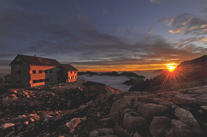
2# Day Two: Rifugio Caldenave to Rifugi or Cima d'Asta
Start your second day by descending from Rifugio Caldenave to the plain, crossing the stream, and following the trail 360 past the beautiful lakes of Val dell'Inferno to reach Forcella delle Buse Todesche. From there, continue north along the trail 373, passing the eastern flank of Cengello and Cima Lasteati. Arrive at Forcella Magna, an important pass connecting Val Sorgazza to Alta Val Cia. During World War I, this pass was serviced by a road (visible ruins) that allowed the Italians to position large artillery pieces. Descend along trail 380 until reaching the right-hand junction for Passo Socede (380 bis) at 2,516 meters, marked by some trench remains. In 15 minutes, traverse granite mounds to reach Rifugio Brentari.
3# Day Three: Rifugio Cima d'Asta to Malga Sorgazza
Begin your final day by descending from Rifugio Brentari on characteristic granite slabs to the base of the cable car. Then, follow a forest road to Malga Sorgazza, completing the loop. Consider climbing Cima d'Asta (2,847 meters - 1 hour and 15 minutes/370 meters of elevation gain), the highest peak in the group, for an exceptional panoramic view.
If you're seeking a scenic trek in the Dolomites, look no further than the Alta Via del Granito. This three-day hike takes you through ancient paths and former military roads dating back to the First World War, connecting two refuges while offering stunning natural landscapes and glimpses of the past. Plan your trip and experience the wonders of the Dolomites firsthand, with Adventoured!